
Cascada El Salto
Cascada El Salto
Parque Nacional Cumbres de Monterrey, Santiago
111 m
5.7 km
2 h
1300 msnm
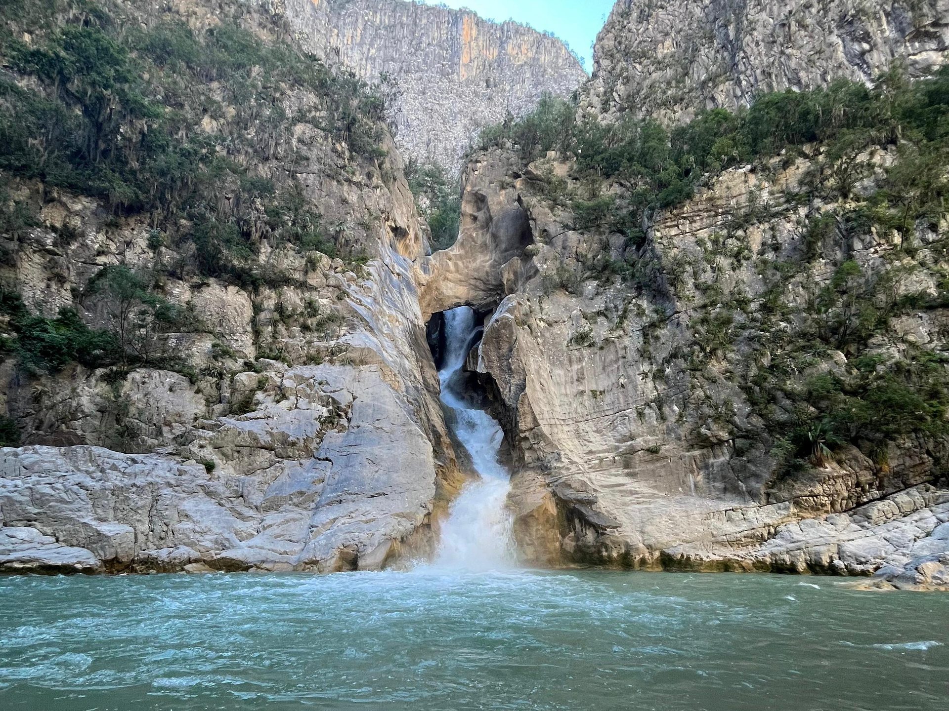
Cascada del Salto in Ciénaga de Gonzales, Santiago: A natural wonder with an impressive water force. While captivating, it can be dangerous.
📢 Alerts & Updates
The El Salto Waterfall is EXTREMELY DANGEROUS! In 2024, swirls in the area have claimed the lives of several hikers. It is currently the most dangerous route in Nuevo León. DON'T GO INTO THE WATERFALL FOR ANY REASON! Your safety comes first. 🚫💧
Warnings


Level
i
Packing List
How to get there
Trailhead Access
Go up the Cola de Caballo road for approximately 45 minutes until you reach the town of Cienega de Gonzales. This road is safe, although some parts are exposed to ravines. A few minutes from reaching Cienega de Gonzales, there is a single-lane passage where vehicles must take turns. It is recommended to avoid going down if it is raining, as it can be very dangerous when braking.
Parking Information
In the town, you can park either at the entrance to the canyon (marked on the Google Maps link) or in the town itself and walk a few minutes to the entrance. 4×4 vehicles can go a few minutes in the canyon, but it's not recommended, as it's almost as slow as walking.
Fees & Park Hours
The cost to park in some parts of the town is $50 MXN, but if the vehicle can go down to the canyon or you find a place on the edge of town, there is no other cost.
Trail Overview
The route is not 100% traced because Tropical Storm Alberto wiped out much of what was already on, although the trail is quite easy to follow. First you walk along the river, crossing it multiple times, until you find a dirt road that will show up about 20 minutes after starting the road. Here, we will follow the dirt road until we reach the waterfall.
Recommended GearN/A

Elevation Gain
111 m
Total Distance (Out & back)
5.7 km
Total Time
2 h
Max Elevation
1300 msnm
The trail is not very demanding, since most of the time we will be walking in the canyon, where there are no ups or downs. Only in the last part, when we descend about 100 meters, does it get a little heavier, although this ascent/descent only takes about 20 to 30 minutes.