
Preparación, Rutas
How to Hike Cerro de las Mitras: Beginner and Advanced Hiking Routes in Monterrey
Introduction
Cerro de las Mitras is one of Monterrey’s most iconic mountains. This guide shows you how to hike it through its most accessible beginner routes and its most demanding summits for advanced hikers, always with a responsible and safety-first approach.
Introduction: Cerro de las Mitras
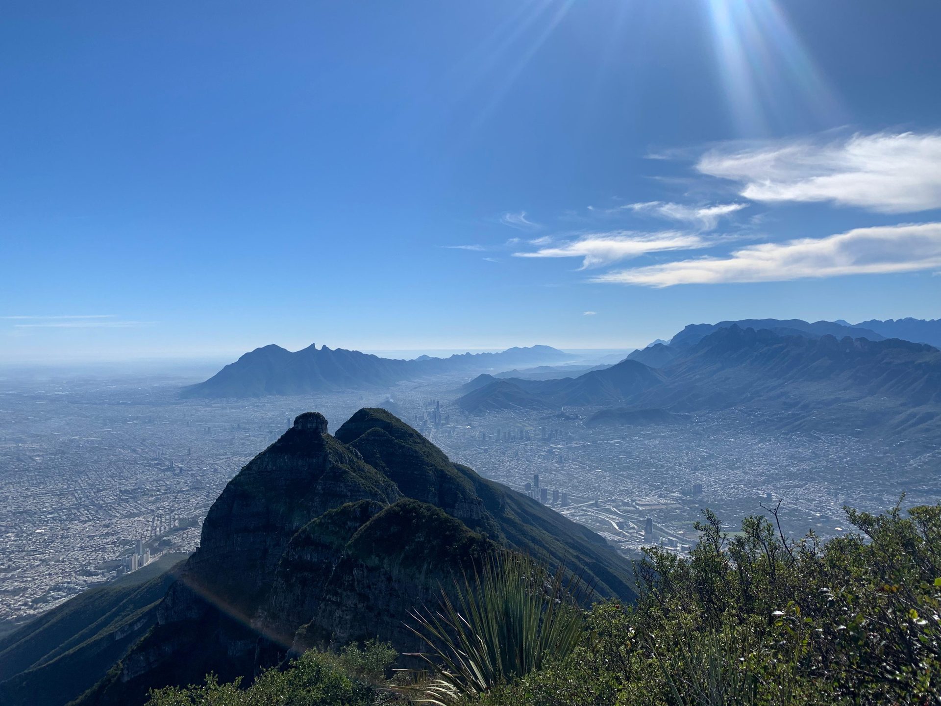
Cerro de las Mitras is one of Monterrey’s most iconic mountains, thanks to its striking mitre-shaped ridgeline, reminiscent of a priest’s ceremonial hat. Its towering limestone walls rise above 2,000 meters above sea level, making it a unique landmark almost as recognizable as Cerro de la Silla.
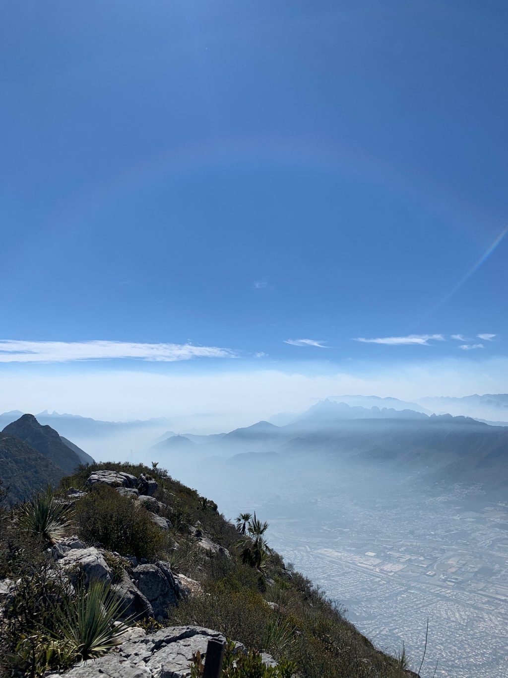
Reaching any of its summits is both a physical and mental challenge, but it also rewards you with breathtaking views of the city and a deep connection with the Sierra Madre Oriental. In this guide, we’ll show you how to hike Cerro de las Mitras through routes suitable for beginners and through more demanding lines designed for intermediate and advanced hikers.
Before choosing a route, always consider your fitness level, the trail’s difficulty and the safety recommendations. In the mountains, the most important summit is getting back home safely.
Pico Piquín: Main Entrance to Cerro de las Mitras
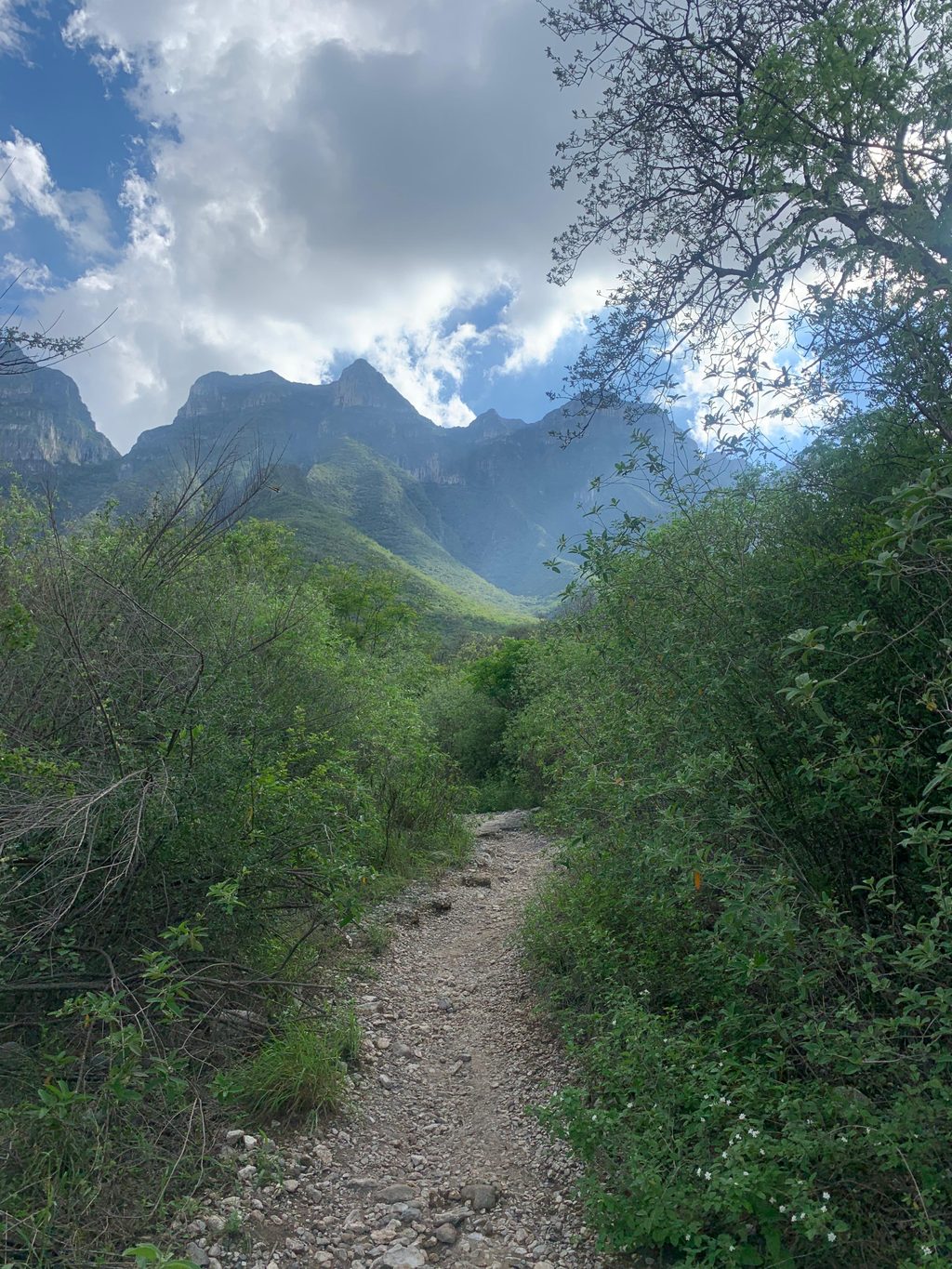
Pico Piquín is one of the best routes to take your first steps on Cerro de las Mitras. The trail weaves through tree-covered paths that provide shade for much of the way and ends at a viewpoint with panoramic vistas of the Monterrey metropolitan area. It’s an ideal route to get to know Mitras’ typical terrain without immediately facing extreme elevation gain or technical scrambling.
- Approximate distance: 4.6 km (out and back)
- Estimated time: 2.5 hours
- Quick tips: bring at least 2 liters of water, light snacks (fruit, nuts, bars), footwear with good grip and always check the weather forecast. Even with shade, avoid the hottest hours of the day.
- More information: Pico Piquín (lacumbrecotidiana.org)
Minas: Exploring an old mining area
The Minas route traverses former mining areas on Cerro de las Mitras. From the very beginning you’ll feel the continuous elevation gain, with steady slopes that test your fitness but still avoid the most technical sections of the higher summits. In return, you get wide views towards the western side of the city and an excellent introduction to the steep character of Mitras.
- Approximate distance: 4.9 km
- Estimated time: 3–4 hours
- Quick tips: bring at least 3 liters of water, sun protection (long sleeves, cap, sunscreen) and trekking poles if you’re not used to sustained climbs. It’s a demanding route for hikers who are just stepping beyond beginner level.
- More information: Minas (lacumbrecotidiana.org)
Puerto La V: A Mountain Pass on Mitras
Puerto La V (also known as Puerto del Aire) is one of the best-known mountain passes on Cerro de las Mitras. The route combines sustained climbs with short sections where you can catch your breath, leading you to a saddle that opens up views towards several of Mitras’ summits. It’s a great option if you already have experience on routes like Pico Piquín and want to take the next step without yet committing to very exposed scrambling.
- Approximate distance: 5.7 km
- Estimated time: 4–5 hours
- Quick tips: plan for at least 3 liters of water, trekking poles to protect your knees on the descent, long sleeves for sun and brush exposure and a headlamp if there’s any chance of finishing late. Starting early is highly recommended. You can find the chimney used by the miners more than 100 years ago!
- More information: Puerto La V (lacumbrecotidiana.org)
Pico del Agua: One of the Most Accessible Summits on Mitras
Pico del Agua is considered one of the most accessible summits on Cerro de las Mitras. While the uphill distance is relatively short, the elevation gain is steady and you’ll feel the effort from the very start. In return, you’ll enjoy privileged views of the city and neighboring summits, making this an excellent transition between beginner and intermediate-level routes.
- Approximate distance: 6 km (full route)
- Estimated time: around 4 hours total (about 2 h 20 min on the ascent)
- Quick tips: bring at least 3 liters of water, some isotonic drink, long-sleeve clothing to protect from thorny vegetation, boots with good grip and trekking poles. Avoid extremely hot days and try to start early.
- More information: Pico del Agua (lacumbrecotidiana.org)
Pico Perico: Steep Elevation Gain and Scrambles
Pico Perico is one of Cerro de las Mitras’ classic advanced routes. Its significant elevation gain and overall length make it a demanding experience, suitable only for hikers with solid fitness and previous mountain experience. Along the way you’ll encounter steep sections, rocky terrain and stretches where pacing and hydration management are essential.
- Approximate distance: 7.8 km
- Estimated time: 6–7 hours
- Quick tips: bring at least 4 liters of water, including some isotonic drink, enough high-energy food for the entire day, boots with excellent grip, trekking poles and clothing suitable for sudden weather changes. This is not a recommended route for your first high-demand mountain outing.
- More information: Pico Perico (lacumbrecotidiana.org)
Pico Cuauhtémoc: The Highest Peak on Mitras
Pico Cuauhtémoc is one of Cerro de las Mitras’ most demanding routes. The ascent crosses the well-known scree slope and includes several vertical scrambles where previous mountain experience, solid foot and hand technique and excellent risk management are essential. While it is not the most technical summit on Mitras, the combination of elevation gain, duration and exposure makes it an advanced route.
- Approximate distance: 5.9 km
- Estimated time: around 4–5 hours
- Quick tips: suitable only for hikers with advanced-route experience. Bring at least 4 liters of water, a helmet, trekking poles for the approach, footwear with very good grip and a basic first-aid kit. Avoid attempting this route with forecasts of rain or strong winds.
- More information: Pico Cuauhtémoc (Wikiloc)
Safety on Cerro de las Mitras
Cerro de las Mitras is as demanding as it is impressive. Before choosing a route, always check your fitness level, the trail’s difficulty and the weather conditions. We recommend that you:
- Avoid hiking alone, especially on advanced routes.
- Tell a trusted person your planned route and estimated return time.
- Check the weather forecast and avoid days with rain, dense fog or extreme heat.
- Carry enough water, high-energy food, warm layers and rain protection according to the season.
- Respect all signage, conservation areas and always pack out all your trash.
If at any point a route feels above your level, do not hesitate to turn around. The mountain will still be there for another day.
Explore More Routes and Learn About Our Difficulty Ratings
If you want to keep exploring the mountains around Monterrey, we invite you to visit our route catalog, ordered from the easiest options to the most demanding ones:
Hiking Route Catalog near Monterrey | La Cumbre Cotidiana
You can also learn how we rate physical effort, technical difficulty and sun exposure on each route in our difficulty classification page: