
Preparación, Rutas
Guide for Intermediate Hikers in Monterrey
Introduction
The Daily Summit has prepared a list for intermediate-level hikers looking to conquer new peaks. We ensure that you learn something new on each mountain, and you can use these skills together to reach more challenging summits in Monterrey. Get to know the mountains of Monterrey in a responsible and safe way.
La Viga: Exploring Low Oxygen Levels
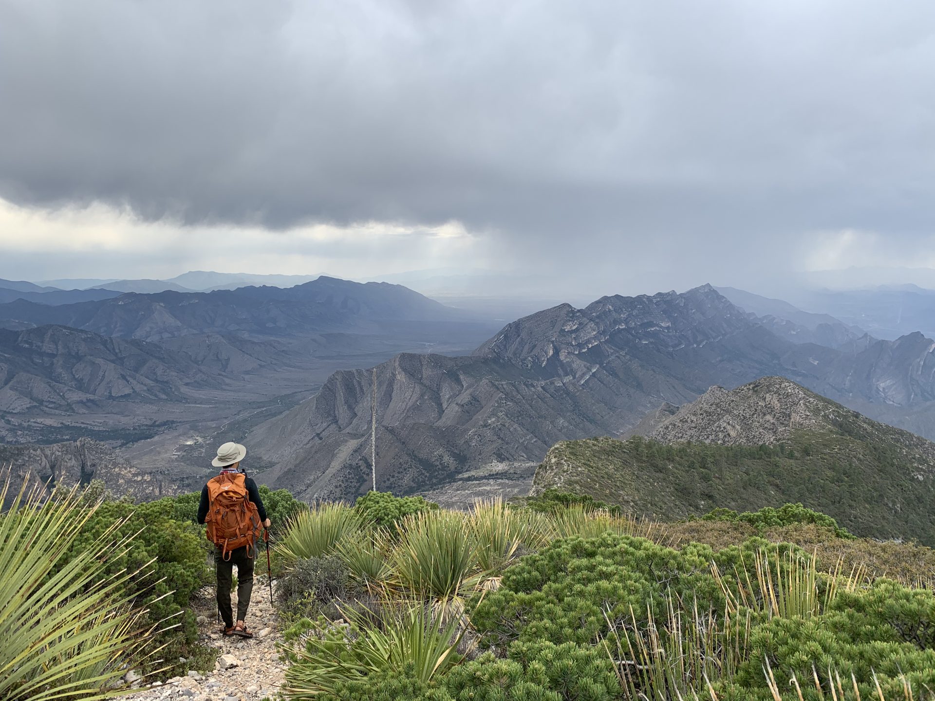
The San Rafael Hill, also known as La Viga, stands out as one of the highest mountains in northern Mexico, reaching 3710 meters above sea level. This elevation leads to an oxygen concentration that ranges from 60 to 70% compared to sea level. In the municipality of Arteaga, many mountains are classified as “high mountains”, which implies different conditions, such as a lower presence of oxygen and a colder climate
.- Distance: 9 km
- Time: 8 hours
- More information: La Viga (lacumbreana.org )
Pico Norte: Challenging Unevities Over Short Distances
With panoramic views of the city of Monterrey, Pico Norte stands as an essential summit for hikers. With an inclination of 50%, the 2.8 kilometers of trail are transformed into hours of challenge and adventure. This ascent is a lesson in minimalism, as you'll feel every gram in your backpack. Most of the ascent will require the use of your hands to navigate the limestone, whose edges can be sharp; therefore, it is essential to wear gloves for protection. In addition to admiring the breathtaking views, this route will teach you the importance of preparation and safety in the mountains
.- Distance: 5.6 km
- Time: 5 hours
- More information: Pico Norte (lacumbreana.org )
Pico UDEM: Challenging Stone Blasters
The UDEM Peak, also known as Pico Indios, exemplifies the distinctive features of the mountains of Nuevo León. Although the distance is short, with only 3 kilometers of climbing, we are faced with steep slopes where the right footwear is crucial. The impressive sandblasting stones stand out, formations common in our mountains. Before visiting this peak, we recommend that you read our publication on the subject to be prepared and make the most of the experience.
- Distance: 6 km
- Time: 7 hours More information:
- Pico UDEM (lacumbreana.org )
Mota Chica: Challenging Sun Exposure
A distinctive feature of this summit is its exposure to the sun. From the start of the ascent, you won't find trees to protect you from the sun until you reach the summit, where pine trees are clustered together (hence the name 'mota'). From the top, you'll enjoy spectacular views of the area and you'll be able to appreciate the varied vegetation of the mountains in this environment. It is advisable to start the ascent early, around 6 am, and wear appropriate clothing to protect yourself from the sun. Once you have conquered this summit, we recommend that you explore others in the area, such as El Sapo, Mota Grande, Pico Alfa or
La Popa.- Distance: 10 km
- Time: 6 hours
- More information: La Mota Chica (lacumbreana.org )
Pico Horcones or Mesa de Morteros: Exploring Short Climbing
Inside the Cumbres de Monterrey National Park, in La Huasteca Park, is one of the favorite mountains of Monterrey hikers due to its breathtaking views. The route covers just 2.8 kilometers, but offers panoramic views, short climbs, desert vegetation and a constant and steep climb
.- Distance: 5.4 km
- Time: 5 hours
- More information: Mesa de Morteros or Pico Horcones ( lacumbreana.org)
Copete de las Aguilas: Climbing with Pre-installed Staples
This mountain offers the best views of the city of Monterrey. Located in the Chipinque Ecological Park, this tour guarantees an adventure full of challenges focused on climbing techniques with pre-installed equipment, making it ideal for lovers of adrenaline and high-altitude experiences. To access it, it is necessary to request authorization through the Chipinque website and complete a registration form
.- Distance: 6.5 km
- Time: 9 hours
- More information: Copete de las Águilas (lacumbreana.org)
Daily Summit Catalog and Difficulty Classifications
Finally, we recommend that you visit our route catalog, which is ordered from the easiest to the most difficult routes. You can access it in the Catalogue of hiking trails near Monterrey | The Everyday Summit. We also invite you to learn about our difficulty classifications in Difficulty Classification (lacumbreana.org).